
To view this content, you need Adobe Flash Player enabled and installed on your device. If your device supports Adobe Flash, you can download the latest version here.
Description
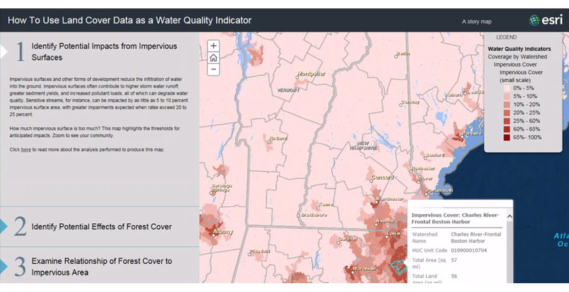
Communities need to understand how land cover affects water quality. This webinar provides information about NOAA’s coastal land cover data (also known as “C-CAP data”). Several tools make these data easier to use, including the Land Cover Atlas, an online viewer used to analyze land cover changes by county or watershed. Also covered: a step-by-step guidance document that helps users understand key water quality indicators.
Learning Outcomes
- Review maps of land cover and change in the coastal U.S.
- Analyze change statistics and maps for a county or watershed of interest
- Identify sensitive watersheds that may be impacted by runoff
- Discover additional resources that can help users assess water quality
Presenter
Nate Herold, NOAA Office for Coastal Management
Rebecca Love, NOAA Office for Coastal Management
Recorded October 27, 2015